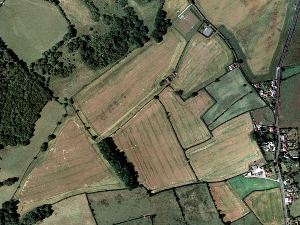
Aerial photography to a very high standard, from two separate companies. Both offer photographs that have their OS Grid positions built into them.
Much of England was photographed in 1999 and 2000. The remainder of the United Kingdom was finished in 2001, plus re-photography of some earlier areas.
High resolution digital image data (25cm resolution on the ground). You can identify fence lines and see where hedges, fences, ditches, etc are along field boundaries. By the end of 2001 it is expected that 6.25cm resolution will be available for some, mainly urban, areas.
You can display the data with any modern graphics program; even insert it into a word processing document, or use it as the base layer in some mapping programs.
For the very first time you can have a seamless mosaic of 1 x 1 km squares of photography, so that OS data and GPS positions can be superimposed on top of the photography in your mapping program.
Resolve many of the queries that you can’t solve with OS data. Useful for LERAP surveys, positioning and measuring new stands of timber, add new field and crop boundaries.
Here’s an example of arable fields with set-aside headlands:

Ordering
The photography is supplied on a CD, or over the Internet, as image data in one of 3 formats – jpeg, bmp, or tiff.
The minimum area that can be ordered is 1 square kilometre, or 100 hectares.
The area required can be specified in a number of ways –
OS 1:2.5k sheet numbers.
OS grid co-ordinates for the area required.
An OS grid co-ordinate for the centre of the area, and the radius around that point.
To ask for a quotation please send an email to [email protected]